Data was last recived from the airplane on Wednesday, April 8, 2026 at 11:58:09 AM California time.
At that time the airplane was on the ground.
The elivation of the ground under the airplane was 6,289 feet above sea level.
Google Map showing last known location
This page will update automatically every 2 minutes or when you manually refresh it. (press F5 on PC)
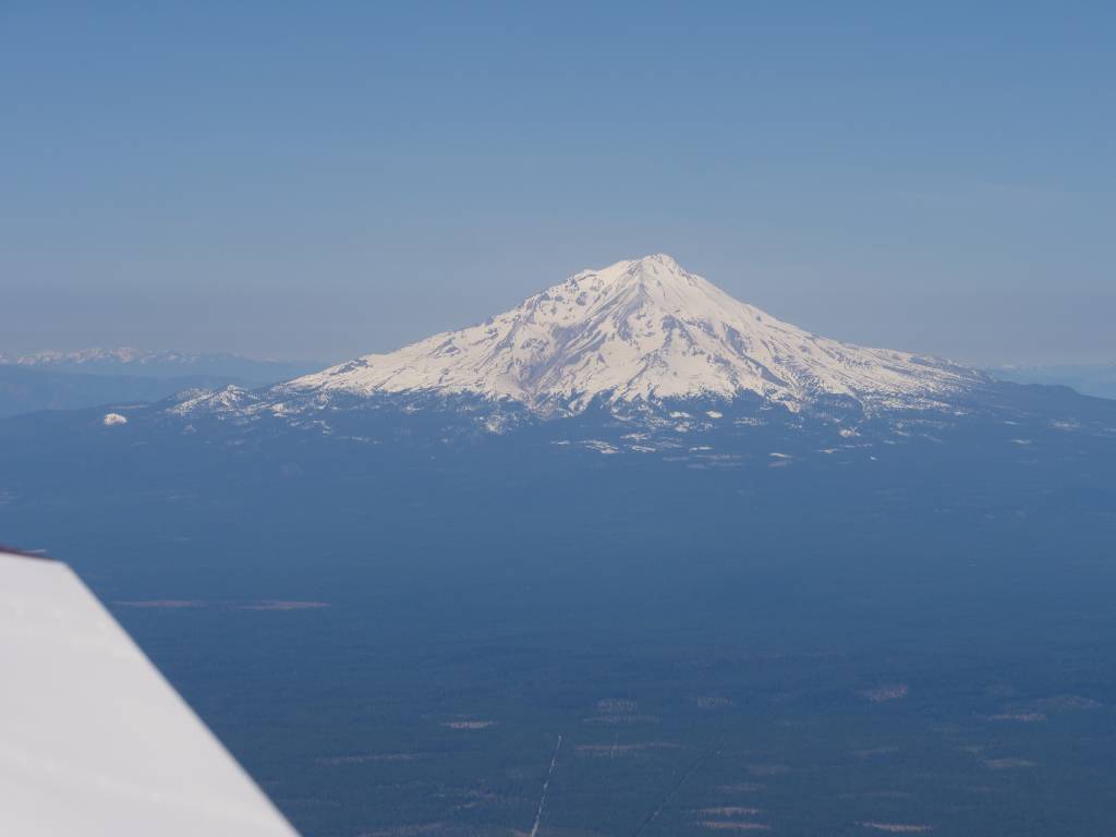
Most recent picture sent from the plane
Picture slide show here
Pictures sent from the airplane are listed here
Complete flight data file (tab-delimited)
NOTE: All dates and times below are GMT
| Field | Value |
|---|---|
| HH_MM_SS_FF | 18:58:08.56 |
| Pitch | -0.8 |
| Roll | 0.2 |
| Yaw | 143 |
| KNTS | 0.0 |
| MPH | 0.0 |
| Altitude | 3980 |
| Turn | -0.0 |
| L_G's | -0.0 |
| V_G's | 1.0 |
| AOA | 99 |
| Prsh_Alt | 3917 |
| VSI | -20 |
| Field | Value |
|---|---|
| HH_MM_SS_FF | 18:58:08.50 |
| O_Tmp | 142 |
| O_Prsr | 41 |
| Volts | 13.1 |
| Amp | -7.5 |
| F_Prsr | 1.9 |
| F_GPH | 0.4 |
| Gal_Rem | 9.4 |
| Left_Tk | 3.4 |
| Right_Tk | 4.5 |
| Flp | 20 |
| E_Trm | 45 |
| A_Trm | 31 |
| RPM | 690 |
| CH1 | 212 |
| CH2 | 217 |
| CH3 | 208 |
| CH4 | 199 |
| CH5 | 187 |
| CH6 | 216 |
| CHA | 206 |
| CH1+- | +6 |
| CH2+- | +11 |
| CH3+- | +2 |
| CH4+- | -7 |
| CH5+- | -19 |
| CH6+- | +10 |
| EG1 | 817 |
| EG2 | 813 |
| EG3 | 885 |
| EG4 | 851 |
| EG5 | 878 |
| EG6 | 788 |
| EGA | 839 |
| EG1+- | -22 |
| EG2+- | -26 |
| EG3+- | +46 |
| EG4+- | +12 |
| EG5+- | +39 |
| EG6+- | -51 |
| Field | Value |
|---|---|
| MM_DD_YY | 04-08-26 |
| HH_MM_SS | 18:43:22 |
| KNTS | 102.3 |
| MPH | 117.8 |
| Latitude | 41.638713 |
| Longitude | -121.511818 |
| Track_T | 13.4 |
| Track_M | 359.9 |
| Altitude_G | 10083 |
| Altitude_A | 10083 |
| Next_Waypnt | |
| Next_Latitude | |
| Next_Longitude | |
| Nxt_NM | |
| Nxt_Bar | |
| Route | |
| Grnd_Elv | 6289 |
| Agl | 3734 |